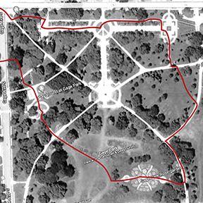
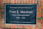
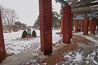
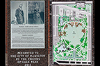
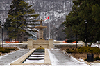
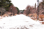
This visit started at the Park entrance on the corner of Main St. E. and Gage Ave. S.. Proceeded to walk east (parallel to Main St. E.) to the red brick columns that make up the Fred E. Marshall memorial. At its center is a small garden plot with a commemorative monument displaying pictures of Howard Grubb and Lorrie Dunington-Grubb, landscape architects for Gage Park. On the other side is the map of the original landscape plan for the Park. Continued the walk eastward between the North Gardens for a view the Fountain from the large circular grassed garden.
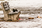
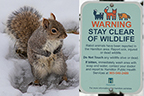
Continued to walk eastward between the North Gardens for a view of a squirrel lunching on leftovers from a (homeless?) person encamped nearby. (A problematic consequence of Covid-19; rising costs of accommodations and living expenses). Ahead can be seen the Robert Burn’s Monument with the Children’s Museum in the background. Turned around for a glance back between the gardens and the Fred E. Marshall monument.
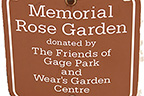
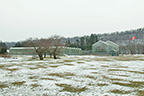
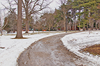
Turned southwest to walk along the pathway where I saw the warning sign “Stay Clear of Wildlife“. Be cautious and observant. Carried on southwest to the Memorial Rose Garden (donated by Friends of Gage Park and Wear’s Garden Centre). The roses are still. Dormant as they rest waiting for spring. In the background can be seen The George E. Robinson Bandshell. Walked on through the garden then headed to the west side of the Park. Had to glance back for a photo of the Greenhouses and new Tropical Greenhouse (tallest).

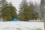
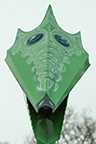
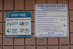
I walk westward to the Children’s Playground and Splash Pad. There the Splash Pad dragon looked down on me “be sure to read the rules”…. The gravel path heads me towards the edge of the park where I follow the tall pines to a concrete block standing out of the grass. This is a Geodetic Survey marker. Look closely to see the circular Bench Mark, “GEODETIC SURVEY OF CANADA” “OTTAWA” “B. M. No.(obscured)”. On the side is a plaque that reads “GEODETIC SURVEY OF CANADA” “The Elevation of this Benchmark is””303.260””Feet Above Mean Sea Level”’Latitude”(obscured) ”Longitude” (obscured) “Azimuth”
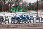
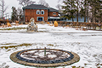
Now, to conclude this visit, I cross Gage Ave. S. and take one last glance (and picture) of the rental bikes, Splash Pad and the Children’s Playground.